Surveying
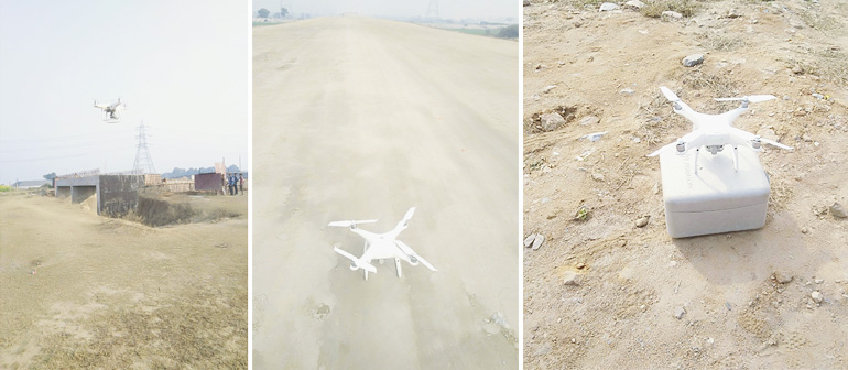
Drone / UAV Survey
A drone survey refers to the use of a drone, or unmanned aerial vehicle (UAV), to capture aerial data with downward-facing sensors, such as RGB or multispectral cameras, and LIDAR payloads. During a drone survey with an RGB camera, the ground is photographed several times from different angles, and each image is tagged with coordinates.
From this data, a photogrammetric software can create geo-referenced orthomosaics, elevation models or 3D models of the project area. These maps can also be used to extract information such as highly-accurate distances or volumetric measurements.
Unlike manned aircraft or satellite imagery, drones can fly at a much lower altitude, making the generation of high-resolution, high-accuracy data, much faster, less expensive and independent of atmospheric conditions such as cloud cover.
Advanced Unmanned Aerial Systems, or UAVs, are essential for acquiring a precise, cost-effective view of your land conveniently from the skies, enabling our teams and every client to understand the scope and purview of every project, big or small, before breaking ground.
- Aerial Mapping of Project Sites
- 3D Rendering and Analysis
- Aerial Construction and Project Updates
- Abbreviated Site Visits
- Close Range Photogrammetry
- Video Inspection of Facility Equipment
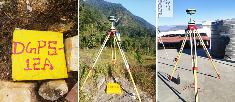
DGPS/GPS Survey
We also undertake jobs pertaining to the areas of Civil Engineering, Field and Physical surveys, e.g. land surveys, alignment studies. We are using latest surveying techniques for making ground corrections. This includes taking highly specialized services of Differential Global Positioning System (DGPS). We have adequate infrastructure and equipment’s like Global Positioning System and Total Stations.
We utilize Differential Global Positioning System (DGPS) to establish GPS control points based on WGS-84 co-ordinate system. Further, Total Station traverse control is carried out between DGPS co-ordinates, to establish co-ordinates of all turning points, intermediate points and the flag control points, so that all co-ordinates are in terms of WGS-84 coordinate system. We deploy Total Station for all survey measurements, readings required for planimetry, information and feature capturing, and levels. All level shall be with respect to Mean Sea Level. The system shall be capable of integrating with advanced computer software for data capturing, down loading and preparation of engineering drawings and alignment sheets. With the data captured, it should be create a Digitized Terrain Model through the use of engineering software.

Topography Survey
Our company has decades of expertise conducting various types of surveys. To conduct out Topographical Survey, we have specialized and skilled staff. In general, topographic surveys are used to detect and map the contours of the earth's surface, as well as those beneath it. We provide the highest quality services on time thanks to our competent and experienced workers in the fields of land surveying, geophysical surveying, topographic surveying, and other surveys. The combination of highly experienced professionals and updated technologies enable us to provide excellent solution with an affordable budget.
The types and required topographical surveys information details are collected on site as per your specification. Hence, our Land Surveying team will not only suggest the most suitable solution but, also take care of other critical issues which might arise in planning application.
Land Survey
From providing the sketch of the area that highlights all the important points to designing the landscape in an efficient manner, we are there for your help. We provides a wide variety of land surveying services for our clients. We perform comprehensive surveying services for commercial and residential developments, buildings, highways, bridges, utilities, waterways and property acquisitions. Our experienced staff of land surveyors utilizes state-of-the-art equipment and practical innovation to reduce survey costs and expedite the completion of projects, while maintaining a superior product for our clients.
We consistently apply unique approaches using the latest technologies to provide quality and timely services, no matter the size of the project.
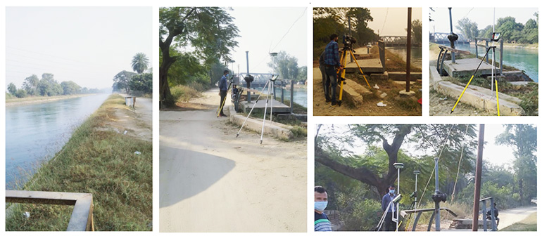
Canal Survey
With the use of latest technology and equipment the surveys are a great help for engineers and architects. We are engaged in offering a qualitative Canal Survey Service to our clients. Canal crossing surveys determine bathymetry of waterways being crossed to establish a suitable route.
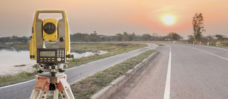
Road And Bridge Survey
These help in the determining condition of the road and suggest the location of a void or gap that can be dangerous. In order to support complex projects, we use the latest technologies and conduct L-section, Cross-section, and Alignment surveys to acquire reliable data for development. We stay mindful to abide by strict safety requirements and possess the experience to regulate on tight schedules. The 3D data collected using the latest technology is used by engineers for the construction and restoration of bridges.

City Survey
We do city mapping with the assistance of DGPS, Topographic Survey and satellite imagery, in which the administrative boundaries, building plots, and other features are captured, and we conduct a door-to-door survey with the help of a mobile app and then develop a GIS data.
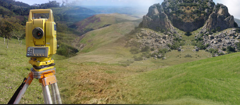
Contour Survey
The contour survey helps in analyzing the contour lines that represents a particular elevation. Our contour survey services are cost effective and can be customized to suffice the client specifications. Primary objective of conducting these surveys is to identify any noticeable difference in elevation of the existing land. Slopes matching the same height are joined using imaginary lines that are known as contours. Contour map highlights details of the existing land condition. Based on the findings of contour survey, the design team can decide on cutting, filling, widening, and leveling the land.
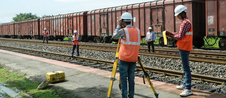
Railway Line Survey
Our expertise is best in class services and use of latest technology and equipment has helped us gain a reputation for ourselves in the railways sector. We are well recognized in the market for successfully offering our customers service backup for carrying out Railway Surveys. These surveys are used in different applications in railway engineering works department. Here, our expertise lies in making use of modern tools as well as advanced process technology that assist us in ensuring qualitative services are delivered to our customers. Further, we also ensure services are also offered in customized specifications as per specific demands of our clients.
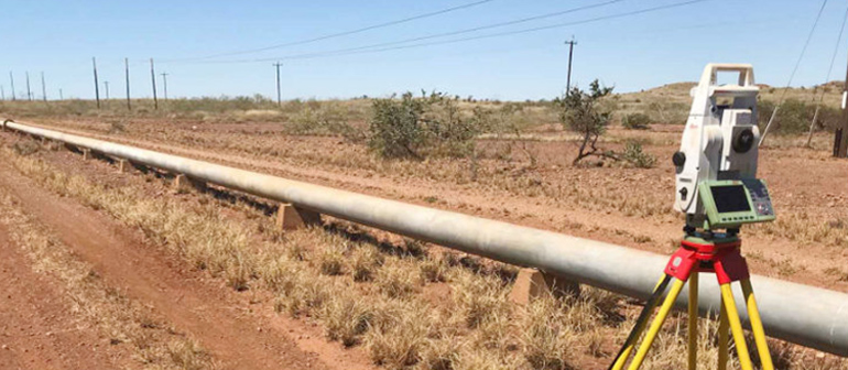
Pipeline Survey – Water, Oil, Sewage, Irrigation And Gas Pipelines
The reliable and competent surveys are helpful for installation and maintenance of pipelines. In order to support complex projects, we use the latest technologies and conduct L-section, Cross-section, and Alignment surveys to acquire reliable data for development. A detailed survey is carried out in order to design pipes.
Transmission Line Survey
A detailed survey is conducted utilizing modern technologies. We fix the route alignment survey and conduct a detailed survey for PLS CAD profile, and tower schedule preparation is done. A contour survey for a tower location and free enumeration for the transmission line corridor.
